Sima Beach Ltd.
5°50'39.41"S
38°49'23.44"E
To view Sima Beach in Google Earth
click here
this will download a
.kml file which you save on your desktop then
just double click to open.
If asked which program to open in choose Google Earth.
home | updates | photos | lease | articles | faq | directions
Flights from/to Saadani/Zanzibar
Coastal Aviation (TZ)
http://www.coastal.co.tz/pdf/Coastal_Schedule_2015_issued_20141002.pdf
Zanzibar Saadani
Daily 09:45 10:00 $75
Saadani Zanzibar Daily 15:15 15:30 $75
Directions to Sima Beach
From Mombasa take the road to Tanzania
Mombasa to Ukunda
25 kms
Ukunda to Kenya border at Lunga Lunga
70kms
Kenya
Border Lunga Lunga to Tanzania border Horohoro
7kms
All the above roads are bitumen to the Kenya standard. i.e. some potholes.
-----------------------------------
Horohoro to Tanga
63 kms
Note: This road is brand new and built as a gift from USA to
the people of Tanzania.
It is probably the best road in Africa.
Beware the police are really on the ball and will fine you for doing
53kph in a 50kph zone.
You must also have triangle, medical kit and current licence and
insurance.
One thing missing and you will be fine TSH 30,000
-----------------------------------
After Tanga
Take the road to Pangani
Tanga to Pangani.
50 kms
Murram road but generally speaking well maintained.
-----------------------------------
After Pangani
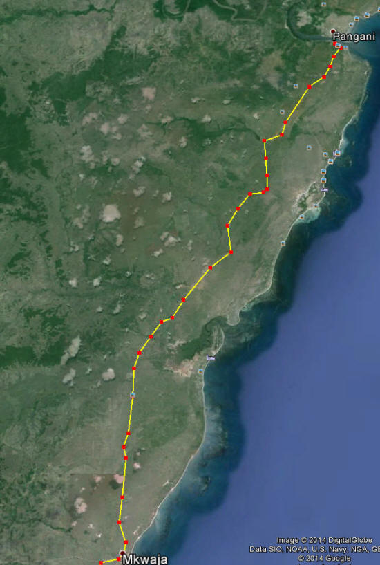
Cross the ferry and take the road to Mkwaja.
Pangani to Mkwaja 50 kms
Note:
After crossing the ferry you continue on the road to the left up the hill.
Only a few kilometres.
At the top of the hill take the right hand road.
NOT the one to Ushongo Beaches.
After another 5? kms you will then come to a fork in the road.
At the fork, take the lower (left) road until you arrive at Mkwaja
which is a total of 44 kms further on.
This road can be a little rough sometimes. Depends on the last time
they graded it.
-----------------------------------
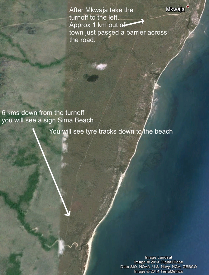
You do not need to go into the village of Mkwaja.
The map below will explain.
About a kilometer past Mkwaja take the left road to the Saadani Game
Park.
The road to the left is just after a drop down barrier across the
road.
This barrier is to control the movement of timber throughout the
country.
If no one is there just drive through.
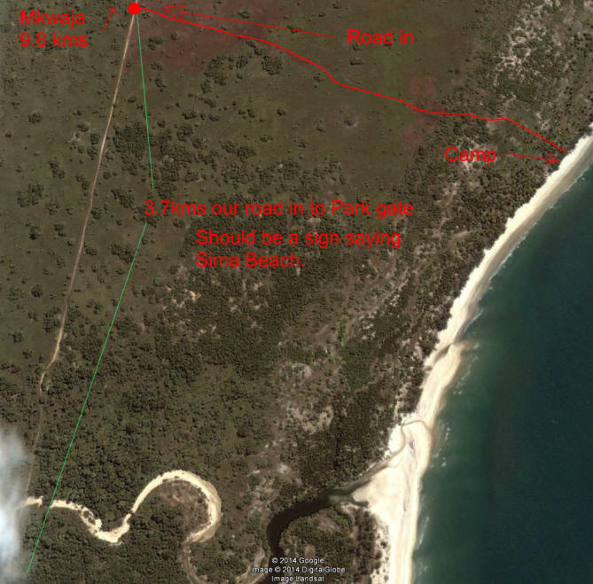
6 Kilometers down the road look for a sign on your left saying Sima
Beach.
If you reach the park gate you have gone 3.5 kms to far.
Tanga Town
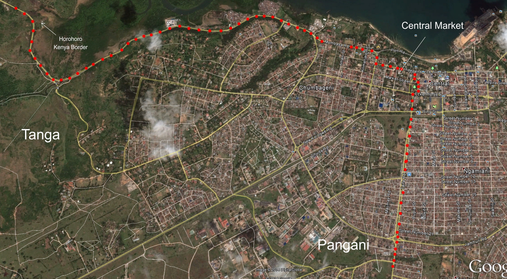
Tanga to Pangani 50 kms
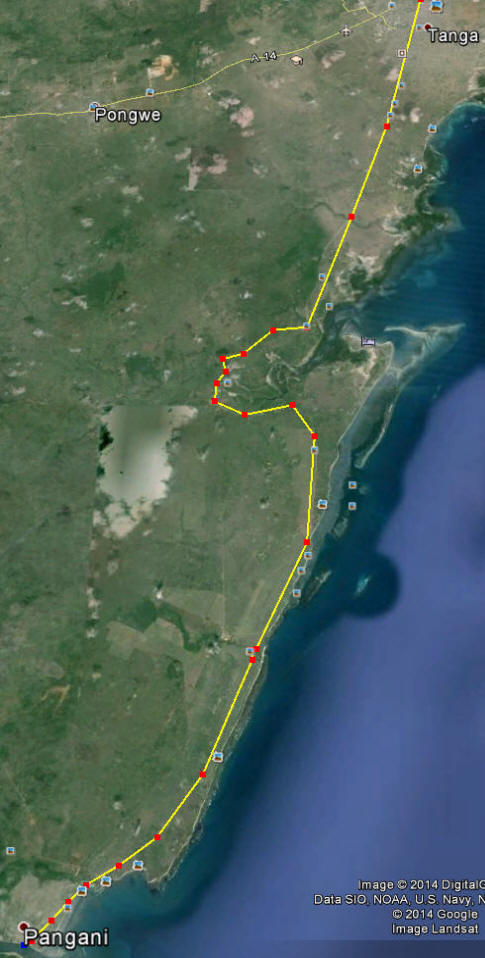
Pangani to Mkwaja 50 kms
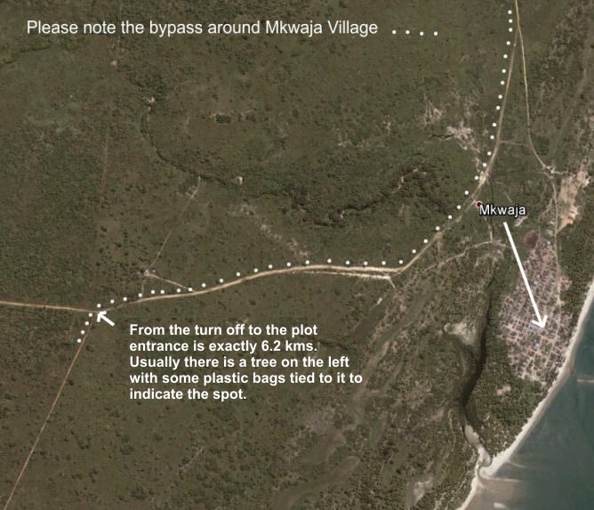
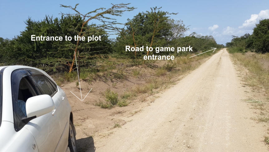
This is the actual entrance to the plot
From Nairobi
Nairobi to Arusha 272 kms
Arusha to Segera 35 kms
Segera to Muheza 35 kms
Muheza to Pangani 42 kms
Pangani to Mkwaj 44 kms
From Arusha: Take the Dar es Salaam road to Segera (370 kms) then
take the road to Tanga.
If the roads are dry, take the short cut at Muheza, which is 35 kms
along the Tanga road. (If not drive onto Tanga and take the Pangani
road from there. )
Turning right near the petrol station where the road sign to Pangani
is located.
When you get to a junction 39 kms down this road turn right towards
Pangani town which is now only 3 kms more.
Once in Pangani, follow the road around to the ferry and cross to
the other side.
After crossing you continue on the road up the hill. A few
kilometers.
At the top of the hill take the righthand road.
NOT the one to Ushongo Beaches.
After another 8 kms you will then come to a fork in the road.
At the fork, take the lower (left) road until you arrive at Mkwaja
which is a total of 44 kms.
From Mkwaja follow the directions below.
Any questions?